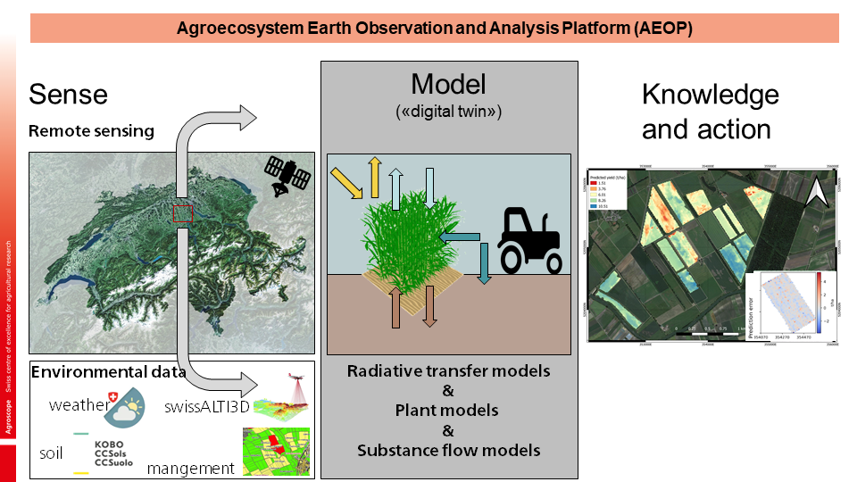
Agroecosystem Earth Observation and Analysis Platform
Our Earth Observation activities are based on our Agroecosystem Earth Observation and analysis Platform (AEOP). It provides the full workflow of sensing, modelling and creating actionable knowledge. It connects various sources of remote sensing, environmental and management data with state-of-the-art statistical algorithms that are able to preprocess and combine different data streams. Moreover, feeding this data into mechanistic models that represent ecophysiological processes allow to generate a “digital twin” of the landscape and interpret observed patterns. The resulting information improves our understanding of ecophysiological processes and acts as a decision support system. The AEOP is powered by EOdal.
EOdal
Our in-house developed Python library EOdal (Earth Observation Data Analysis Library) is a novel software that enables the development of fully reproducible spatial data science chains through the strict use of open-source developments. Thanks to its modular design, EOdal enables advanced data warehousing especially for remote sensing data, sophisticated spatio-temporal analysis and intersection of different data sources, as well as nearly unlimited expandability through application programming interfaces (APIs).
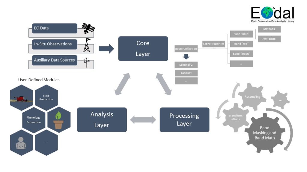
EOdal consists of three layers as shown in Figure above. The layers are organized in a triangle to emphasize their inter-dependencies. The core layer provides the Python classes required to perform I/O operations to read and write geo-spatial data sets in a generic way. It is also the basis for data warehousing, i.e., the storage of metadata. Class inheritance extends its capabilities to specific EO sensors such as S2 MSI (e.g., for convenient reading of data organized in the Satellite Archive for Europe, SAFE, structure). (Pre-)processing of these datasets is accomplished in the processing layer. Processing steps such as spatial reprojection are often a necessity to combine different datasets for analysis. The analysis layer enables automatized, reproducible EO data management and is the backbone for data-driven analysis of geo-spatial data sets and their spatio-temporal intersection.